How does one stream “capture” another?
River beheadings and other violent imagery from millions of years ago

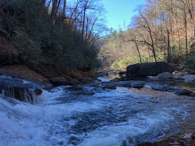
Eons ago the Wild and Scenic Chattooga River (where the movie Deliverance was filmed) was captured by another river and pulled over a ridge and into the Atlantic basin. How does an entire river, meandering through the landscape and minding its own business, suddenly abandon its course and jump the rim of a mountain to join a neighboring stream? It seems the distant strains of banjo music aren’t the only freaky thing about this river.
Let me back up…
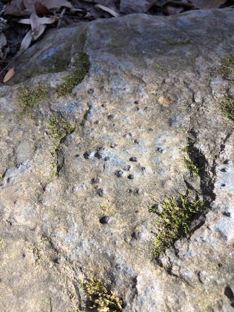
Last week I attended a geology class at our local nature center just because I’m curious and my knowledge of rocks doesn’t extend past teaching third graders about the rock cycle. I learned a lot in this class, not the least of which is that much of our local rock is mica schist, which tends to be covered in tiny garnets:
The instructor recommended buying Roadside Geology of Georgia, which turns out to be a fascinating and very comprehensible guide to the rocks and soils and topography of my state (there are Roadside Geology books for many states – check to see if yours has one!)
From that book I discovered that I live practically on top of the Brevard Fault line, which travels through several states. The red X is approximately where I live:

The existence of the fault line likely explains the topography of our area. In the photo below, notice farmland to the left and right of a hilly, forested swath in the middle. The fault line runs parallel and to the left (west) of those hills, with the farmland to the east actually sitting about 500 feet lower in elevation. The middle forested section is actually a large ridge that forms the continental divide: water to the west flows to the Chattahoochee River and then to the Gulf of Mexico. Water to the east of the ridge flows to the Atlantic. The Brevard Fault Zone participated in the formation of the Appalachian Mountains over 300 million years ago, and our small ridge is likely a remnant of its movement.
But here’s where it gets even more interesting…
That continental ridge continues northward another 10 miles or so until it encounters the almost 1,000-foot-deep Tallulah Gorge, which cuts across it from north to south.
The authors of Roadside Geology of Georgia state (and then websites here and here confirmed) that the Tallulah Gorge is a fairly recent phenomena, in geological terms. It seems that the Chattooga River, seen above zigzagging from the northeast near Opossum Creek Falls, used to flow north of where Tallulah Falls is now. It fed the upper reaches of the Chattahoochee River with its waters flowing into the Gulf of Mexico. At the same time, to the south the Tugaloo River flowed approximately where the red arrow lies.
But when two water systems exist at different elevations, the lower one tends to erode away into the upper. That’s what happened when a tributary of the Tugaloo River eroded away the ridge that separated it from the Chattooga to the north – at some point, it broke through and a torrent of water began to eat away at the rock, creating the Tallulah Gorge. The Chattooga was “captured” by the Tugaloo, resulting in a sharp turn in the river that meant its waters now flowed to the Atlantic and were cut off from the Chattahoochee.
Over time, the Chattooga formed a new riverbed and the Tallulah River continued through the Gorge. Because the rocks of the chasm are hard quartzite, they form large drops and tumultuous rapids in the Tallulah Gorge, and the walls of the Gorge remain fairly steep compared to the sloping banks of the upper Chattooga, which are lined with softer mica schist.
While this process happened so long ago that the original Chattooga streambed cannot be seen, the same is not true of the stream capture that formed the Nantahala Gorge. I grew up in the Nantahala Gorge, which is famous for whitewater rafting and being deep enough to earn its name “Land of the Noonday Sun.” Like the Tallulah, the Nantahala Gorge was formed by a stream capture event.
This wonderful, very thorough site by geologist Philip Prince explains the process by which the Gorge was formed. Basically, eons ago, the Nantahala and the Little Tennessee Rivers flowed in separate valleys, with the Tennessee flowing at an elevation several hundred feet lower:

Over time, a tributary of the Little Tennessee ate through the soft rocks of the intervening ridge (there’s now a talc and limestone quarry there). This caused the Nantahala to make a sharp 90 degree turn into the Gorge and eventually connect with the Little Tennessee River below, as seen in this satellite image from Dr. Prince’s site:
Different than with the stream capture of the Chattooga, the original channel of the Nantahala remains visible. Above, you can see the outline of the old Nantahala as it meandered westward through shallow valleys. In the present day, geologists realize what appears to be a simple depression in the landscape is actually the remnants of an ancient riverbed.
It’s even more impressive when viewed via photo:
Over eons, the new course of the Nantahala deepened the Gorge by 800 feet (and continues eating away the riverbed each year). The photo above clearly illustrates the path of both the old and current river.
Attending that brief geology class last week has made me look at rocks and topography from a completely different viewpoint. Every rock hints at massive forces that formed the land millions of years ago. I’ve suddenly realized I’ve been ignoring most of the inorganic parts of the forest on my walks in favor of the trees, plants, birds and animal poop that tells the ongoing story of the forest. But the rocks and hill formations and creases and valleys tell just as much of a story, just on a larger scale and a longer time period. My goal is to learn enough to be able to understand that story too…
Weird Nature:
(click to see the video)


This is cool. I used to drive past an example in Marlborough many years ago. I can't remember the name of the river now though.
I also came across a similar phenomenon where a retreating glacier caused a river to completely disappear.
These essays just keep getting more and more interesting! Or at least to me since I love Geology and own three of those yellow State roadside geology books. This was fascinating to read since I know next to nothing about Eastern U.S geology! Must be fun to live on a fault!